The Historic Columbia River Highway was constructed between 1913 and 1922 by entrepreneur Sam Hill and engineer Samuel Lancaster. It was modeled after the great scenic roads of Europe.

Reconnecting the Old Highway
The Columbia Gorge Scenic Act of 1986 directed the State of Oregon to re-connect the abandoned highway sections as a pedestrian and cyclist trail. The Historic Highway State Trail (bike and hiking map) allows bikers and hikers to travel most of the route from Troutdale to The Dalles, much as it was 100 years ago. Gorge Towns to Trails is a vision to link communities with recreation and tourism.

The Columbia River Gorge National Scenic Act, over 25 years ago, had a dual mandate of protection and economic development explains OPB’s Oregon Field.
The Gorge has the largest concentration of waterfalls in the lower 48 states. The US Forest Service overviews the first 10 miles of this journey with a focus on wheelchair accessible stops. Magnificent viewpoints in the first few miles include Portland Women’s Forum Scenic Viewpoint (Chanticleer Point) and Vista House at Crown Point.

The historic highway parallels Interstate 84. It takes you past dozens of waterfalls, including Multnomah Falls, the most visited natural site in Oregon. An Oral History Project collected anecdotal memories of the highway’s construction.
The Historic Trail
Several sections, designated as the State Historic Trail, are for hikers and bikers only. The Historic Trail sections (bike map) are impassable by vehicles.

Some 63 of the original 73 miles of the Historic Columbia River Highway are now open to travel either by motor vehicle or by foot and bicycle (State Trail). A 1.2 mile off-highway path that goes from Lindsey Creek to Starvation Creek was completed in 2016, leaving only the 10 mile Mitchell Point Segment left. Freeway access is required in that section.

A new 1.3-mile section of the trail opens in 2016, but the most challenging sections remain unfunded and unplanned: getting through Mitchell Point and around Shellrock Mountain. The final five miles are estimated to cost over $30 million and could require a tunnel and rock-blasting to punch the path through to Hood River, reports BikePortland.

Waterfall Alley has seven major year-round waterfalls between Troutdale and Dodson, Ore.

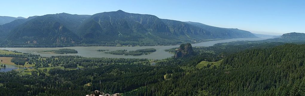
On the Washington side, narrow shoulders make the main highway (SR-14) poor for biking but separate bike paths are sometimes available. Between the Bridge of the Gods and Vancouver, the Cape Horn trail really showcases the Columbia River.

Unfortunately, the Historic Highway State Trail route (maps) is currently closed for bicycle riders to ride from Bridal Veil to Hood River, but open between Hood River and Mosier. Bicycle users who want to bike all the way through should consider crossing the Columbia River and use Highway 14 on the Washington side as an alternate. The State Trail from the Mark Hatfield trailhead (near Hood River) to the Dalles is open while the rest of the trail and West of Cascade Locks is currently CLOSED due to the 2017 Eagle Creek fire.
On this tour we’re (mostly) driving, but we’re bringing bikes to explore the car-restricted sections. We’ll check out some Oregon State Parks and use the Oregon State Parks Pass and NW Forests Pass to cover most incidental fees while exploring.
Scenic viewpoints and great hikes are everywhere along the 80 mile drive, whether you’re on the Interstate, the Historic Highway, biking or hiking on the Historic Trail, or traveling on the Washington State side. Many visitors start near the city of Troutdale and travel east on the Historic Highway. That’s our route.
We have divided our trip into 12 sections, 8 sections going east and 4 sections returning back to Portland. Click on the Google bike map to jump to a section. There are also reference pages in back for biking and hiking.
Navigating This Site

2. I-84 (Exit 22) to Vista House

3. Vista House to Multnomah Falls

4. Mult Falls to Cascade Locks

5. Cascade Locks to Hood River


8. The Dalles to Biggs Junction


11. White Salmon to Bridge of the Gods

12. Bridge of the Gods to I-205 Bridge
